Trail Walking Saint-Julien-en-Quint - Pas de la Couronne - Photo
 aldaus
aldaus

User

© OpenStreetMap contributors
Length
Length
16 km
Max alt
Max alt
1440 m
Uphill gradient
Uphill gradient
897 m
Km-Effort
Km-Effort  
28 km
Min alt
Min alt
756 m
Downhill gradient
Downhill gradient
898 m
Boucle
Boucle
Yes
Creation date :
2024-04-17 07:42:58.936
Updated on :
2024-04-17 12:37:29.915

(0 Reviews)

Walking
Walking
4h40
Difficulty : Medium

Scan this QR Code to open this trail in the SityTrail application

FREE GPS app for hiking

Logo SityTrail SityTrail

IGN / Geographical institutes

Download SityTrail from the App Store Download SityTrail from Google Play

Logo SityTrail SityTrail World

The world is yours!

Download SityTrail from the App Store Download SityTrail from Google Play Download SityTrail on Huawei AppGallery

About

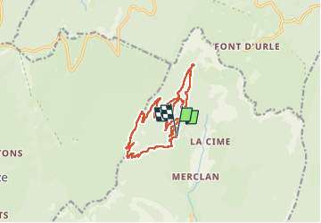
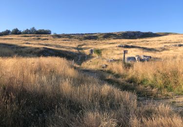
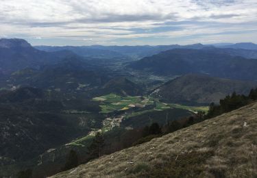
Trail Walking of 16 km to be discovered at Auvergne-Rhône-Alpes, Drôme, Saint-Julien-en-Quint. This trail is proposed by aldaus.

Description

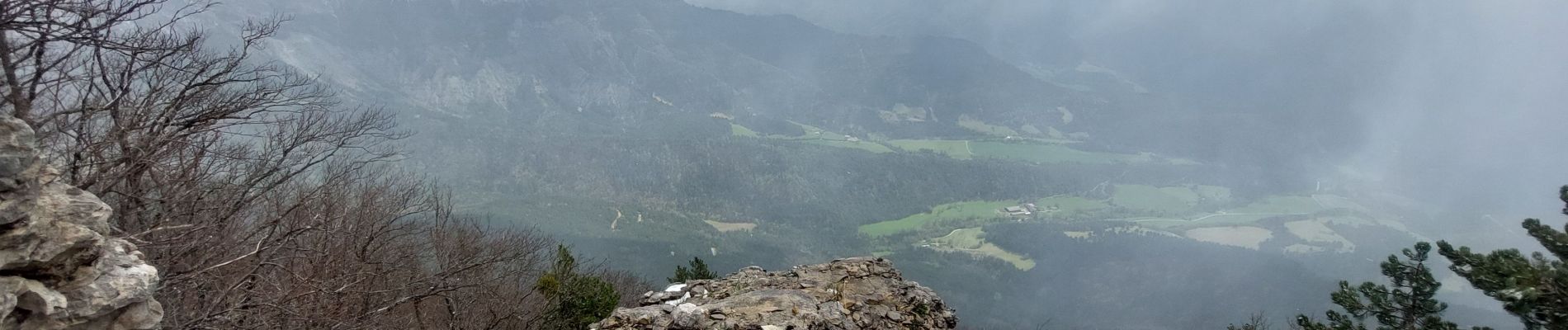
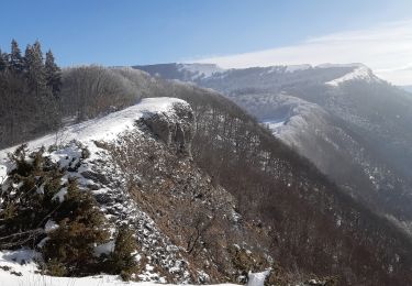
trop de brouillard et de neige pour le pas de la Douille....changement d itinéraire !
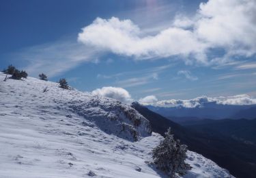
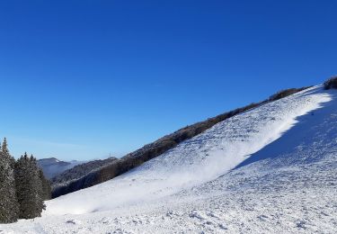
30 degré avant hier...3 aujourd'hui avec la neige et le vent...pour un 17 Avril !

Elevation profile

Photos

Positioning

Country:
France
Region :
Auvergne-Rhône-Alpes
Department/Province :
Drôme
Municipality :
Saint-Julien-en-Quint
Location:
Unknown
Start:(UTM)
681258 ; 4971571 (31T) N.

Trails nearby

Trail Snowshoes Bouvante - Les gagères en raquettes - Photo
Snowshoes
Simon Brabant

Snowshoes

Medium
(1)
Bouvante, Auvergne-Rhône-Alpes, Drôme, France
9.2 km | 14.2 km-effort
3h 40min
Yes
Trail Walking Omblèze - 2021-07-26_17h20m33_1627312809705_Plateau d_Ambel 15km.gpx.xml - Photo
Walking
chancha

Walking

Very difficult
(1)
Omblèze, Auvergne-Rhône-Alpes, Drôme, France
14.9 km | 22 km-effort
4h 56min
Yes
Trail Walking Bouvante - 01 - Photo
Walking
Noiraude

Walking

Medium
(1)
Bouvante, Auvergne-Rhône-Alpes, Drôme, France
12.5 km | 19.5 km-effort
5h 7min
Yes
Trail Walking Saint-Julien-en-Quint - pas de bouillanain st julien en Quint  - Photo
Walking
alinetpierre

Walking

Difficult
Saint-Julien-en-Quint, Auvergne-Rhône-Alpes, Drôme, France
17 km | 29 km-effort
5h 6min
Yes
Trail Walking Bouvante - Font d’Urle les Trois cloches Glacières les Gagères  - Photo
Walking
alinetpierre

Walking

Difficult
Bouvante, Auvergne-Rhône-Alpes, Drôme, France
11.9 km | 17.9 km-effort
4h 4min
Yes
Trail Walking Vassieux-en-Vercors - But St Genis - Photo
Walking
ajd26

Walking

Easy
Vassieux-en-Vercors, Auvergne-Rhône-Alpes, Drôme, France
12.8 km | 20 km-effort
3h 52min
Yes
Trail Walking Vassieux-en-Vercors - Forêt communale de Dié - Photo
Walking
Greg813

Walking

Medium
Vassieux-en-Vercors, Auvergne-Rhône-Alpes, Drôme, France
10.7 km | 14.8 km-effort
3h 29min
Yes
Trail Walking Bouvante - Crête des Gagères - Photo
Walking
Greg813

Walking

Medium
Bouvante, Auvergne-Rhône-Alpes, Drôme, France
8.3 km | 11.6 km-effort
2h 10min
Yes
Trail Nordic walking Bouvante - 202201fontdurle2 - Photo
Nordic walking
michelfehrenbach

Nordic walking

Very easy
Bouvante, Auvergne-Rhône-Alpes, Drôme, France
4.3 km | 6 km-effort
1h 58min
Yes


Close
My subscriptions