Trail Walking Halle - #240419 - Bois de Hal - Photo

#240419 - Bois de Hal

© OpenStreetMap contributors
Length
Length
6.9 km
Max alt
Max alt
140 m
Uphill gradient
Uphill gradient
119 m
Km-Effort
Km-Effort  
8.5 km
Min alt
Min alt
63 m
Downhill gradient
Downhill gradient
121 m
Boucle
Boucle
Yes
Creation date :
2024-04-18 07:16:04.757
Updated on :
2024-04-27 09:46:35.418

(1 Reviews)

Walking
Walking
1h55
Difficulty : Medium

Scan this QR Code to open this trail in the SityTrail application

FREE GPS app for hiking

Logo SityTrail SityTrail

IGN / Geographical institutes

Download SityTrail from the App Store Download SityTrail from Google Play

Logo SityTrail SityTrail World

The world is yours!

Download SityTrail from the App Store Download SityTrail from Google Play Download SityTrail on Huawei AppGallery

About

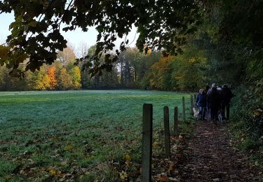
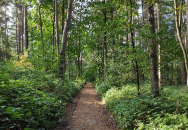
Trail Walking of 6.9 km to be discovered at Flanders, Flemish Brabant, Halle. This trail is proposed by Randos Ouvertes.

Description

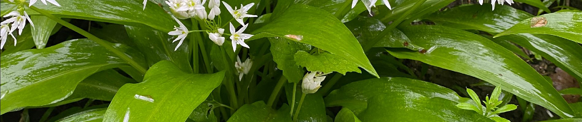
Nouveau circuit inédit au départ du Parking n° 1 (un des deux seuls parkings accessibles pendant le Festival des jacinthes*****, mi-avril > début mai). Ce circuit est exceptionel par sa beauté, et pas que à la saison de jacinthes ! Il est assez physique avec ses 130 m (!) de dénivelé pour 7 km. La première partie est en dehors du bois et passe par la splendide cuvette*** du Steenputbeek pour remonter ensuite vers l'entrée du bois à hauteur de la brasserie 't Kriekske. Le circuit aborde des parties accidentées et, au sud, des parties plus plates. Le bruit est gênant lorsque les chemins passent près ring R0. A faire absolument !

Crédits photos : Béatrice Walsdorff, Sophie Vermote et Yvette Lallemand.

Elevation profile

Photos

25 photos in total. Please click on a photo to see them all in the gallery.

Positioning

Country:
Belgium
Region :
Flanders
Department/Province :
Flemish Brabant
Municipality :
Halle
Location:
Halle
Start:(Dec)
Start:(UTM)
589491 ; 5618686 (31U) N.

Comments

Please log in to post a review or rate the element


Trails nearby

Trail Walking Braine-le-Château - RB-Bw-14 - Raccourci 1 - Au nord de Braine-le-Château, à travers de petites réserves naturelles - Photo
Walking
PRO

Walking

Very difficult
(6)
Braine-le-Château, Wallonia, Walloon Brabant, Belgium
17.1 km | 22 km-effort
4h 56min
Yes
Trail Walking Braine-le-Château - RB-Bw-14_Braine-le-Château - Photo
Walking
PRO

Walking

Very difficult
(7)
Braine-le-Château, Wallonia, Walloon Brabant, Belgium
23 km | 29 km-effort
6h 30min
Yes
Trail Walking Braine-le-Château - RB-Bw-14 - Raccourci 2 - Au nord de Braine-le-Château, à travers de petites réserves naturelles - Photo
Walking
PRO

Walking

Difficult
(12)
Braine-le-Château, Wallonia, Walloon Brabant, Belgium
11.2 km | 14.9 km-effort
3h 22min
Yes
Trail Walking Braine-le-Château - Marche Adeps á  Braine-le-Château  - Photo
Walking
GUIDE
Desrumaux

Walking

Very easy
(1)
Braine-le-Château, Wallonia, Walloon Brabant, Belgium
10.5 km | 13.7 km-effort
3h 6min
Yes
Trail Walking Braine-le-Château - Balade à Braine-le-Château - Photo
Walking
GUIDE
Desrumaux

Walking

Easy
(2)
Braine-le-Château, Wallonia, Walloon Brabant, Belgium
10.8 km | 13.7 km-effort
3h 0min
Yes
Trail Walking Halle - Balade dans le Bois de Halle - Photo
Walking
GUIDE
Desrumaux

Walking

Easy
(2)
Halle, Flanders, Flemish Brabant, Belgium
8.6 km | 10.5 km-effort
2h 14min
Yes
Trail Walking Braine-le-Château - #201214 - Braine-le-Château, Les Monts, Les Fonds et Bruyère Landuyt - Photo
Walking
Randos Ouvertes

Walking

Medium
(1)
Braine-le-Château, Wallonia, Walloon Brabant, Belgium
7.8 km | 10.2 km-effort
2h 11min
Yes
Trail Walking Braine-le-Château - Braine le château 22 km - Photo
Walking
GUIDE
rvapeldo

Walking

Difficult
(2)
Braine-le-Château, Wallonia, Walloon Brabant, Belgium
23 km | 29 km-effort
5h 10min
Yes
Trail Walking Braine-le-Château - Braine le château - Photo
Walking
liteanu

Walking

Medium
(1)
Braine-le-Château, Wallonia, Walloon Brabant, Belgium
16.1 km | 21 km-effort
5h 24min
Yes


Close
My subscriptions