


Les marcheurs du Pontus 18 avril 2024

cheepewa
User

Length
10.8 km

Max alt
73 m

Uphill gradient
74 m
Km-Effort
11.7 km

Min alt
56 m

Downhill gradient
75 m
Boucle
Yes
Creation date :
2024-04-18 06:27:57.0
Updated on :
2024-04-18 09:18:55.269

FREE GPS app for hiking
 SityTrail
IGN / Geographical institutes
SityTrail Plus
The world is yours!
About
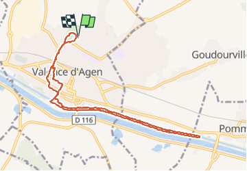
Trail of 10.8 km to be discovered at Occitania, Tarn-et-Garonne, Valence. This trail is proposed by cheepewa.
Description
Jardin du Pontus, canal des 2mers jusqu’à écluse de Pommevic et retour
Photos


Positioning
Country:
France
Region :
Occitania
Department/Province :
Tarn-et-Garonne
Municipality :
Valence
Location:
Unknown
Start:(Dec)
Start:(UTM)
331421 ; 4887070 (31T) N.
Comments