


SityTrail - 3933835 - reco-valbonex-le-parc-de-la-braque

clintest
User
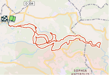

Length
16.6 km

Max alt
228 m

Uphill gradient
424 m
Km-Effort
22 km

Min alt
72 m

Downhill gradient
422 m
Boucle
Yes
Creation date :
2024-04-18 14:53:16.847
Updated on :
2024-04-18 14:53:16.847

FREE GPS app for hiking
 SityTrail
IGN / Geographical institutes
SityTrail Plus
The world is yours!
About
Trail of 16.6 km to be discovered at Provence-Alpes-Côte d'Azur, Maritime Alps, Valbonne. This trail is proposed by clintest.
Positioning
Country:
France
Region :
Provence-Alpes-Côte d'Azur
Department/Province :
Maritime Alps
Municipality :
Valbonne
Location:
Unknown
Start:(Dec)
Start:(UTM)
339578 ; 4833717 (32T) N.
Comments