


2019-03-21-hardricourt-2

Rando MLC
User
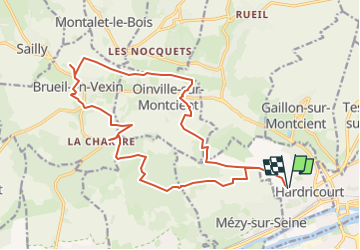

Length
19.3 km

Max alt
189 m

Uphill gradient
348 m
Km-Effort
24 km

Min alt
45 m

Downhill gradient
347 m
Boucle
Yes
Creation date :
2024-04-20 13:38:52.487
Updated on :
2024-04-21 07:44:28.462
5h11
Difficulty : Medium

FREE GPS app for hiking
 SityTrail
IGN / Geographical institutes
SityTrail Plus
The world is yours!
About
Trail On foot of 19.3 km to be discovered at Ile-de-France, Yvelines, Hardricourt. This trail is proposed by Rando MLC.
Positioning
Country:
France
Region :
Ile-de-France
Department/Province :
Yvelines
Municipality :
Hardricourt
Location:
Unknown
Start:(Dec)
Start:(UTM)
418814 ; 5428976 (31U) N.
Comments