


2019-03-21-hardricourt-1

Rando MLC
User

Length
9 km

Max alt
164 m

Uphill gradient
142 m
Km-Effort
10.9 km

Min alt
72 m

Downhill gradient
139 m
Boucle
Yes
Creation date :
2024-04-20 15:21:50.247
Updated on :
2024-04-21 07:37:37.389
2h28
Difficulty : Easy

FREE GPS app for hiking
 SityTrail
IGN / Geographical institutes
SityTrail Plus
The world is yours!
About
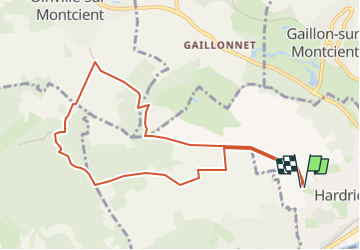
Trail On foot of 9 km to be discovered at Ile-de-France, Yvelines, Hardricourt. This trail is proposed by Rando MLC.
Positioning
Country:
France
Region :
Ile-de-France
Department/Province :
Yvelines
Municipality :
Hardricourt
Location:
Unknown
Start:(Dec)
Start:(UTM)
418726 ; 5428975 (31U) N.
Comments