


les lucioles

GILOU440
User

Length
6.8 km

Max alt
132 m

Uphill gradient
196 m
Km-Effort
9.4 km

Min alt
16 m

Downhill gradient
199 m
Boucle
Yes
Creation date :
2024-04-20 20:11:56.059
Updated on :
2024-04-20 22:09:57.853
1h57
Difficulty : Medium

FREE GPS app for hiking
 SityTrail
IGN / Geographical institutes
SityTrail Plus
The world is yours!
About
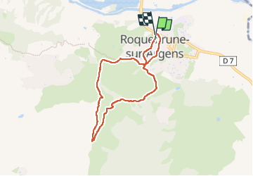
Trail Walking of 6.8 km to be discovered at Provence-Alpes-Côte d'Azur, Var, Roquebrune-sur-Argens. This trail is proposed by GILOU440.
Description
de nuit
Photos

Positioning
Country:
France
Region :
Provence-Alpes-Côte d'Azur
Department/Province :
Var
Municipality :
Roquebrune-sur-Argens
Location:
Unknown
Start:(Dec)
Start:(UTM)
308748 ; 4812885 (32T) N.
Comments