


ter22 04

ROBERT-MICHEL
User
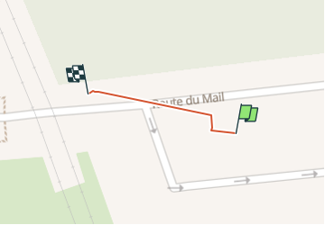

Length
36 m

Max alt
79 m

Uphill gradient
0 m
Km-Effort
36 m

Min alt
79 m

Downhill gradient
0 m
Boucle
No
Creation date :
2024-04-22 10:37:34.82
Updated on :
2024-04-22 10:39:47.648
2m
Difficulty : Easy

FREE GPS app for hiking
 SityTrail
IGN / Geographical institutes
SityTrail Plus
The world is yours!
About
Trail Walking of 36 m to be discovered at Ile-de-France, Yvelines, Saint-Germain-en-Laye. This trail is proposed by ROBERT-MICHEL.
Positioning
Country:
France
Region :
Ile-de-France
Department/Province :
Yvelines
Municipality :
Saint-Germain-en-Laye
Location:
Saint-Germain-en-Laye
Start:(Dec)
Start:(UTM)
433629 ; 5417258 (31U) N.
Comments