


L’alarme

pierre.chau
User
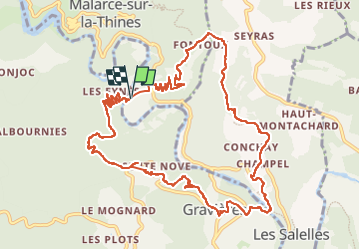

Length
14.5 km

Max alt
401 m

Uphill gradient
483 m
Km-Effort
21 km

Min alt
160 m

Downhill gradient
478 m
Boucle
Yes
Creation date :
2024-04-22 08:13:12.0
Updated on :
2024-05-07 22:32:26.276

FREE GPS app for hiking
 SityTrail
IGN / Geographical institutes
SityTrail Plus
The world is yours!
About
Trail of 14.5 km to be discovered at Auvergne-Rhône-Alpes, Ardèche, Malarce-sur-la-Thines. This trail is proposed by pierre.chau.
Description
Très jolie Rando
Positioning
Country:
France
Region :
Auvergne-Rhône-Alpes
Department/Province :
Ardèche
Municipality :
Malarce-sur-la-Thines
Location:
Unknown
Start:(Dec)
Start:(UTM)
585672 ; 4920814 (31T) N.
Comments