Dan47 - 2025 Haut Fays

istadaniel
User
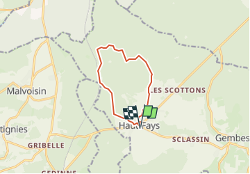

Length
8.6 km

Max alt
446 m

Uphill gradient
138 m
Km-Effort
10.4 km

Min alt
340 m

Downhill gradient
137 m
Boucle
Yes
Creation date :
2024-04-22 17:08:46.728
Updated on :
2025-05-13 06:57:37.675
2h22
Difficulty : Medium

FREE GPS app for hiking
 SityTrail
IGN / Geographical institutes
SityTrail Plus
The world is yours!
About
Trail Walking of 8.6 km to be discovered at Wallonia, Luxembourg, Daverdisse. This trail is proposed by istadaniel.
Positioning
Country:
Belgium
Region :
Wallonia
Department/Province :
Luxembourg
Municipality :
Daverdisse
Location:
Unknown
Start:(Dec)
Start:(UTM)
644598 ; 5540616 (31U) N.
Comments