


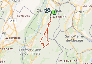
38 Couvent St Michel Champ / drac

ericf64
User

Length
9.4 km

Max alt
1007 m

Uphill gradient
768 m
Km-Effort
19.7 km

Min alt
301 m

Downhill gradient
777 m
Boucle
Yes
Creation date :
2024-04-23 07:22:39.907
Updated on :
2024-04-23 10:32:52.438
3h00
Difficulty : Medium

FREE GPS app for hiking
 SityTrail
IGN / Geographical institutes
SityTrail Plus
The world is yours!
About
Trail Walking of 9.4 km to be discovered at Auvergne-Rhône-Alpes, Isère, Champ-sur-Drac. This trail is proposed by ericf64.
Description
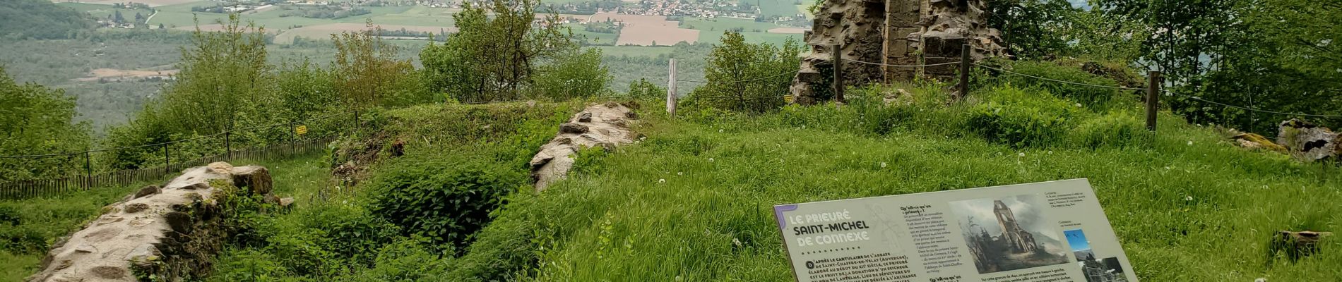
boucle avec une belle vue, monter et descente raides, mais sans cailloux
Photos


Positioning
Country:
France
Region :
Auvergne-Rhône-Alpes
Department/Province :
Isère
Municipality :
Champ-sur-Drac
Location:
Unknown
Start:(Dec)
Start:(UTM)
715048 ; 4994328 (31T) N.
Comments