


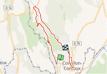
cornillon.pont de rhaud

NADINE52
User

Length
8.8 km

Max alt
116 m

Uphill gradient
142 m
Km-Effort
10.5 km

Min alt
34 m

Downhill gradient
84 m
Boucle
No
Creation date :
2024-04-23 08:56:56.528
Updated on :
2024-04-23 13:32:31.658
2h25
Difficulty : Medium

FREE GPS app for hiking
 SityTrail
IGN / Geographical institutes
SityTrail Plus
The world is yours!
About
Trail Walking of 8.8 km to be discovered at Provence-Alpes-Côte d'Azur, Bouches-du-Rhône, Cornillon-Confoux. This trail is proposed by NADINE52.
Positioning
Country:
France
Region :
Provence-Alpes-Côte d'Azur
Department/Province :
Bouches-du-Rhône
Municipality :
Cornillon-Confoux
Location:
Unknown
Start:(Dec)
Start:(UTM)
666634 ; 4825356 (31T) N.
Comments