Trail Walking Stavelot - Stavelot  - Photo
© OpenStreetMap contributors
Length
Length
23 km
Max alt
Max alt
589 m
Uphill gradient
Uphill gradient
497 m
Km-Effort
Km-Effort  
29 km
Min alt
Min alt
267 m
Downhill gradient
Downhill gradient
523 m
Boucle
Boucle
No
Creation date :
2024-04-20 06:04:07.28
Updated on :
2024-04-23 14:46:51.388

(0 Reviews)

Walking
Walking
5h14
Difficulty : Medium

Scan this QR Code to open this trail in the SityTrail application

FREE GPS app for hiking

Logo SityTrail SityTrail

IGN / Geographical institutes

Download SityTrail from the App Store Download SityTrail from Google Play

Logo SityTrail SityTrail World

The world is yours!

Download SityTrail from the App Store Download SityTrail from Google Play Download SityTrail on Huawei AppGallery

About

Trail Walking of 23 km to be discovered at Wallonia, Liège, Stavelot. This trail is proposed by Cyrille Williaume.

Description

Marche fédérale avril 2024

Elevation profile

Positioning

Country:
Belgium
Region :
Wallonia
Department/Province :
Liège
Municipality :
Stavelot
Location:
Unknown
Start:(UTM)
707756 ; 5586110 (31U) N.

Trails nearby

Trail Walking Trois-Ponts - RB-Lg-29_Wanne - Photo
Walking
PRO

Walking

(5)
Trois-Ponts, Wallonia, Liège, Belgium
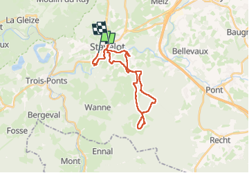
22 km | 29 km-effort
6h 41min
Yes
Trail Walking Trois-Ponts - RB-Lg-27_Trois-Ponts - Photo
Walking
PRO

Walking

(7)
Trois-Ponts, Wallonia, Liège, Belgium
23 km | 33 km-effort
7h 30min
Yes
Trail Walking Stavelot - 2021-06-30_12h14m27_stavelot_13km_new - Photo
Walking
GUIDE
mumu.larandonneuse

Walking

Medium
(2)
Stavelot, Wallonia, Liège, Belgium
13.4 km | 19.8 km-effort
4h 30min
Yes
Trail Walking Stavelot - 2021-03-10_14h59m08_1227 - Photo
Walking
GUIDE
mumu.larandonneuse

Walking

Difficult
(3)
Stavelot, Wallonia, Liège, Belgium
18.8 km | 26 km-effort
5h 53min
No
Trail Walking Trois-Ponts - RB-Lg-27_Trois-Ponts_via-racc - Photo
Walking
PRO

Walking

Very difficult
(1)
Trois-Ponts, Wallonia, Liège, Belgium
16.9 km | 25 km-effort
5h 36min
Yes
Trail Walking Stavelot - Chemin des Sources |stage 3 STAVELOT - HOCKAI - Photo
Walking
PRO

Walking

Very difficult
(1)
Stavelot, Wallonia, Liège, Belgium
19 km | 25 km-effort
5h 45min
No
Trail Trail Stavelot - Extratrail - Stavelot (red) 23km - Photo
Trail
PRO

Trail

Very difficult
(1)
Stavelot, Wallonia, Liège, Belgium
23 km | 35 km-effort
Unknown
Yes
Trail Trail Stavelot - Extra Trail - Stavelot (blue) 13km - Photo
Trail
PRO

Trail

Difficult
(1)
Stavelot, Wallonia, Liège, Belgium
13.4 km | 19.5 km-effort
Unknown
Yes
Trail Trail Stavelot - Extratrail - Stavelot (green) 9km - Photo
Trail
PRO

Trail

Medium
(1)
Stavelot, Wallonia, Liège, Belgium
10.1 km | 13.9 km-effort
Unknown
Yes


Close
My subscriptions