


circuit de la Malepère

Mascart
User

Length
11.3 km

Max alt
317 m

Uphill gradient
222 m
Km-Effort
14.2 km

Min alt
162 m

Downhill gradient
221 m
Boucle
Yes
Creation date :
2024-04-23 11:22:48.288
Updated on :
2024-04-23 15:49:30.114
3h00
Difficulty : Medium

FREE GPS app for hiking
 SityTrail
IGN / Geographical institutes
SityTrail Plus
The world is yours!
About
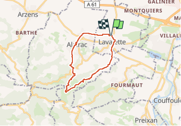
Trail Walking of 11.3 km to be discovered at Occitania, Aude, Lavalette. This trail is proposed by Mascart.
Description
sens Lavalette Alairac
Positioning
Country:
France
Region :
Occitania
Department/Province :
Aude
Municipality :
Lavalette
Location:
Unknown
Start:(Dec)
Start:(UTM)
440294 ; 4781982 (31T) N.
Comments