


Ardèche étap3 Gorges1

taguette
User
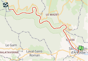

Length
15.7 km

Max alt
197 m

Uphill gradient
525 m
Km-Effort
23 km

Min alt
45 m

Downhill gradient
496 m
Boucle
No
Creation date :
2024-04-24 08:13:37.804
Updated on :
2024-04-24 15:02:21.61
5h58
Difficulty : Very difficult

FREE GPS app for hiking
 SityTrail
IGN / Geographical institutes
SityTrail Plus
The world is yours!
About
Trail Walking of 15.7 km to be discovered at Occitania, Gard, Aiguèze. This trail is proposed by taguette.
Positioning
Country:
France
Region :
Occitania
Department/Province :
Gard
Municipality :
Aiguèze
Location:
Unknown
Start:(Dec)
Start:(UTM)
624872 ; 4906187 (31T) N.
Comments