


SityTrail - Col de la Pisse (Incontournables n°14)

frizou83
User

Length
18.6 km

Max alt
3143 m

Uphill gradient
1446 m
Km-Effort
38 km

Min alt
1699 m

Downhill gradient
1445 m
Boucle
Yes
Creation date :
2024-04-25 11:58:51.608
Updated on :
2024-04-25 12:30:13.658
8h36
Difficulty : Very difficult

FREE GPS app for hiking
 SityTrail
IGN / Geographical institutes
SityTrail Plus
The world is yours!
About
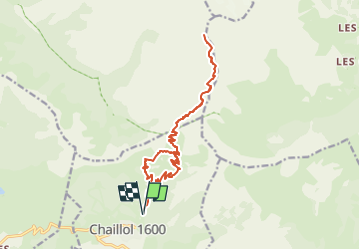
Trail Walking of 18.6 km to be discovered at Provence-Alpes-Côte d'Azur, Hautes-Alpes, Saint-Michel-de-Chaillol. This trail is proposed by frizou83.
Positioning
Country:
France
Region :
Provence-Alpes-Côte d'Azur
Department/Province :
Hautes-Alpes
Municipality :
Saint-Michel-de-Chaillol
Location:
Unknown
Start:(Dec)
Start:(UTM)
275689 ; 4952670 (32T) N.
Comments