


Ardèche étape gorges

taguette
User

Length
19.8 km

Max alt
408 m

Uphill gradient
507 m
Km-Effort
26 km

Min alt
63 m

Downhill gradient
499 m
Boucle
No
Creation date :
2024-04-25 06:45:01.627
Updated on :
2024-04-25 13:05:07.382
6h19
Difficulty : Very difficult

FREE GPS app for hiking
 SityTrail
IGN / Geographical institutes
SityTrail Plus
The world is yours!
About
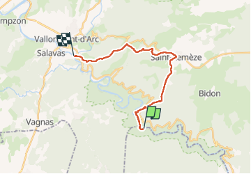
Trail Walking of 19.8 km to be discovered at Auvergne-Rhône-Alpes, Ardèche, Saint-Remèze. This trail is proposed by taguette.
Positioning
Country:
France
Region :
Auvergne-Rhône-Alpes
Department/Province :
Ardèche
Municipality :
Saint-Remèze
Location:
Unknown
Start:(Dec)
Start:(UTM)
617122 ; 4910872 (31T) N.
Comments