


ruffieu

loca.yves
User GUIDE
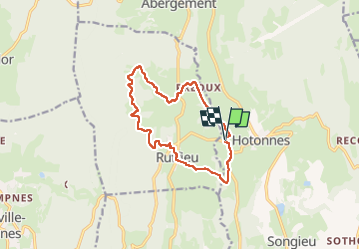

Length
12.2 km

Max alt
914 m

Uphill gradient
397 m
Km-Effort
17.5 km

Min alt
636 m

Downhill gradient
398 m
Boucle
Yes
Creation date :
2024-04-25 11:15:50.924
Updated on :
2024-04-25 15:15:19.547
3h58
Difficulty : Difficult

FREE GPS app for hiking
 SityTrail
IGN / Geographical institutes
SityTrail Plus
The world is yours!
About
Trail Walking of 12.2 km to be discovered at Auvergne-Rhône-Alpes, Ain, Haut Valromey. This trail is proposed by loca.yves.
Description
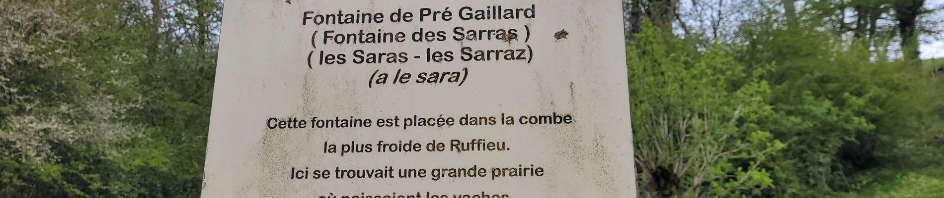
très belle
Photos


Positioning
Country:
France
Region :
Auvergne-Rhône-Alpes
Department/Province :
Ain
Municipality :
Haut Valromey
Location:
Hotonnes
Start:(Dec)
Start:(UTM)
707564 ; 5097240 (31T) N.
Comments