


02/04/2015 Rando ski Pic Negre d'Envalira

chrisbal
User
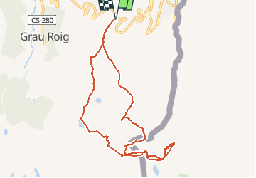

Length
13.7 km

Max alt
2792 m

Uphill gradient
1040 m
Km-Effort
28 km

Min alt
2330 m

Downhill gradient
1041 m
Boucle
Yes
Creation date :
2017-05-25 00:00:00.0
Updated on :
2020-06-15 11:51:55.029
--
Difficulty : Medium

FREE GPS app for hiking
 SityTrail
IGN / Geographical institutes
SityTrail Plus
The world is yours!
About
Trail Touring skiing of 13.7 km to be discovered at Andorra. This trail is proposed by chrisbal.
Positioning
Country:
Andorra
Region :
Unknown
Department/Province :
Unknown
Municipality :
Unknown
Location:
Unknown
Start:(Dec)
Start:(UTM)
394835 ; 4710528 (31T) N.
Comments