


Sentier de Pagnol

francisdean
User
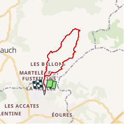

Length
10.8 km

Max alt
662 m

Uphill gradient
548 m
Km-Effort
18.1 km

Min alt
131 m

Downhill gradient
550 m
Boucle
Yes
Creation date :
2015-04-03 00:00:00.0
Updated on :
2015-04-03 00:00:00.0
3h42
Difficulty : Difficult

FREE GPS app for hiking
 SityTrail
IGN / Geographical institutes
SityTrail Plus
The world is yours!
About
Trail Walking of 10.8 km to be discovered at Provence-Alpes-Côte d'Azur, Bouches-du-Rhône, Marseille. This trail is proposed by francisdean.
Description
Rando de Visorando, Dan83.
www.visorando.com/randonnee-circuit-marcel-pagnol.pdf
Positioning
Country:
France
Region :
Provence-Alpes-Côte d'Azur
Department/Province :
Bouches-du-Rhône
Municipality :
Marseille
Location:
11th Arrondissement
Start:(Dec)
Start:(UTM)
703739 ; 4798502 (31T) N.
Comments