


Collège

charpe
User
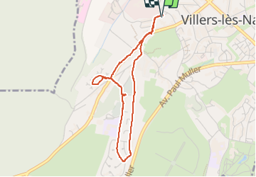

Length
3.6 km

Max alt
346 m

Uphill gradient
88 m
Km-Effort
4.8 km

Min alt
263 m

Downhill gradient
89 m
Boucle
Yes
Creation date :
2024-04-27 08:13:02.0
Updated on :
2024-04-27 09:20:44.384
1h07
Difficulty : Easy

FREE GPS app for hiking
 SityTrail
IGN / Geographical institutes
SityTrail Plus
The world is yours!
About
Trail Walking of 3.6 km to be discovered at Grand Est, Meurthe-et-Moselle, Villers-lès-Nancy. This trail is proposed by charpe.
Positioning
Country:
France
Region :
Grand Est
Department/Province :
Meurthe-et-Moselle
Municipality :
Villers-lès-Nancy
Location:
Unknown
Start:(Dec)
Start:(UTM)
289852 ; 5395080 (32U) N.
Comments