


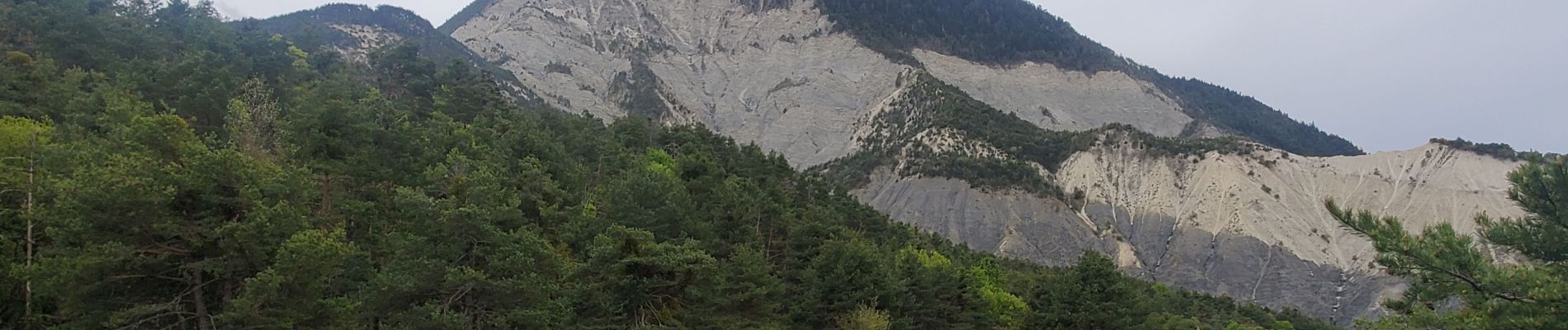
tartonne la sapé 14.5kms 800m

Danielba
User GUIDE
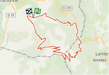

Length
13.5 km

Max alt
1700 m

Uphill gradient
791 m
Km-Effort
24 km

Min alt
942 m

Downhill gradient
788 m
Boucle
Yes
Creation date :
2024-04-30 06:48:21.295
Updated on :
2024-04-30 16:53:48.55
6h37
Difficulty : Easy

FREE GPS app for hiking
 SityTrail
IGN / Geographical institutes
SityTrail Plus
The world is yours!
About
Trail Walking of 13.5 km to be discovered at Provence-Alpes-Côte d'Azur, Alpes-de-Haute-Provence, Tartonne. This trail is proposed by Danielba .
Photos

Positioning
Country:
France
Region :
Provence-Alpes-Côte d'Azur
Department/Province :
Alpes-de-Haute-Provence
Municipality :
Tartonne
Location:
Unknown
Start:(Dec)
Start:(UTM)
291884 ; 4882092 (32T) N.
Comments