


Saverne et ses châteaux

VacheKiri67
User


6h59
Difficulty : Difficult

FREE GPS app for hiking
 SityTrail
IGN / Geographical institutes
SityTrail Plus
The world is yours!
About
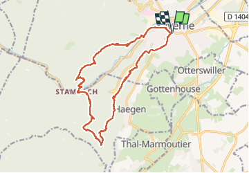
Trail Walking of 17.5 km to be discovered at Grand Est, Bas-Rhin, Saverne. This trail is proposed by VacheKiri67.
Description
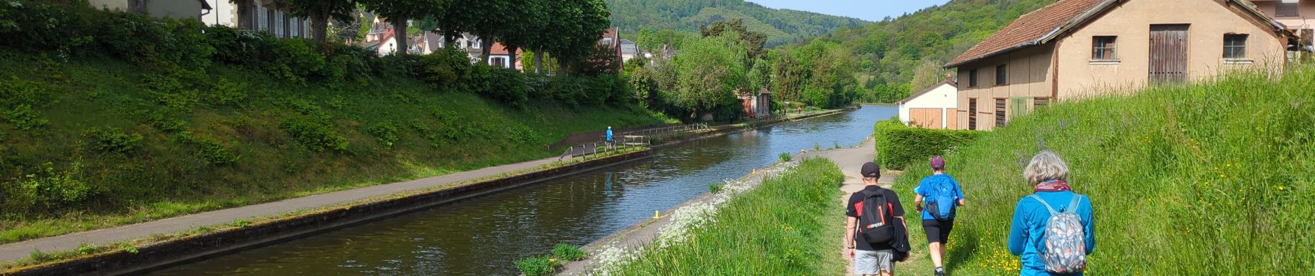
Faite le 01/05/2024 avec nos amis Francine et Christian.
Départ : parking des Dragons à Saverne.
De nombreuses curiosités parsèment ce parcours assez physique. La durée peut donc varier selon le temps passé pour la visite des sites : Greifenstein, Chapelle Saint-Vit, Rappenfels, tour du Brotchberg, Petit et Grand Gerolsdseck, tour Chappe, Haut-Barr.
Photos


47 photos in total. Please click on a photo to see them all in the gallery.
Positioning
Comments