


Bagnols en Forêt circuit des meules 03-05-24

Christiancordin
User
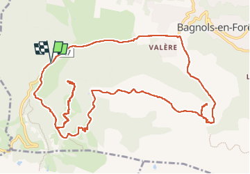

Length
15.8 km

Max alt
440 m

Uphill gradient
475 m
Km-Effort
22 km

Min alt
208 m

Downhill gradient
473 m
Boucle
Yes
Creation date :
2024-05-03 07:51:48.042
Updated on :
2024-05-12 16:31:06.607
4h14
Difficulty : Medium

FREE GPS app for hiking
 SityTrail
IGN / Geographical institutes
SityTrail Plus
The world is yours!
About
Trail Walking of 15.8 km to be discovered at Provence-Alpes-Côte d'Azur, Var, Bagnols-en-Forêt. This trail is proposed by Christiancordin.
Description
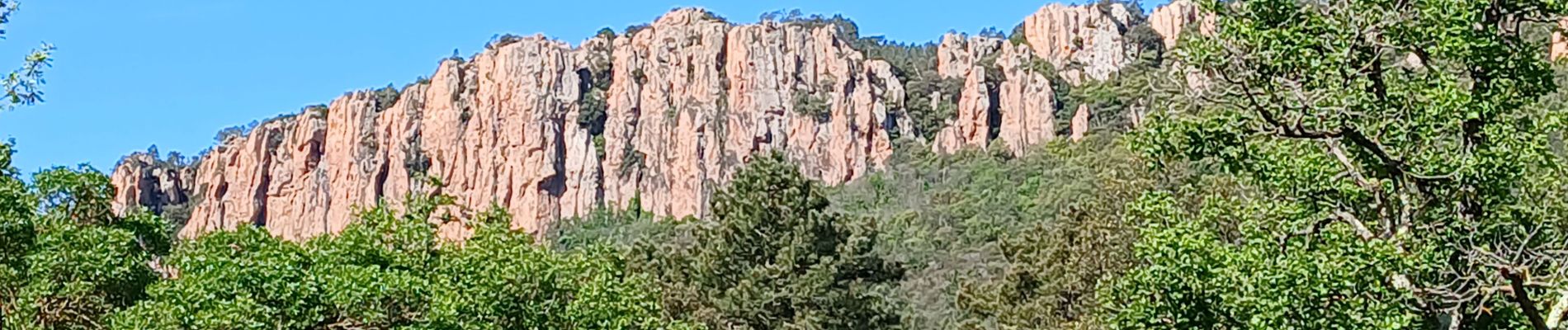
Piste de Bayonne, point de vue, église des païens, ancienne meulière, oppidum la forteresse, col de la pierre du coucou, les Cigarières, ND de la Pitié, D47.
Photos


Positioning
Country:
France
Region :
Provence-Alpes-Côte d'Azur
Department/Province :
Var
Municipality :
Bagnols-en-Forêt
Location:
Unknown
Start:(Dec)
Start:(UTM)
310687 ; 4822454 (32T) N.
Comments