


balade printaniere

gilbertdu60
User

Length
18.2 km

Max alt
100 m

Uphill gradient
163 m
Km-Effort
20 km

Min alt
26 m

Downhill gradient
112 m
Boucle
No
Creation date :
2015-04-05 00:00:00.0
Updated on :
2015-04-05 00:00:00.0
2h32
Difficulty : Medium

FREE GPS app for hiking
 SityTrail
IGN / Geographical institutes
SityTrail Plus
The world is yours!
About
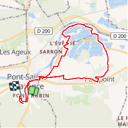
Trail Cycle of 18.2 km to be discovered at Hauts-de-France, Oise, Pont-Sainte-Maxence. This trail is proposed by gilbertdu60.
Description
les terriers étangs de pont point retour pont se Maxence les terriers
Positioning
Country:
France
Region :
Hauts-de-France
Department/Province :
Oise
Municipality :
Pont-Sainte-Maxence
Location:
Unknown
Start:(Dec)
Start:(UTM)
471176 ; 5459989 (31U) N.
Comments