


métro rando vif le gua

sabine38
User
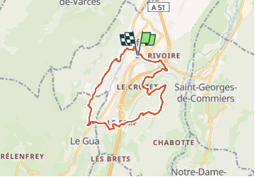

Length
14.8 km

Max alt
849 m

Uphill gradient
676 m
Km-Effort
24 km

Min alt
307 m

Downhill gradient
677 m
Boucle
Yes
Creation date :
2024-05-05 05:37:08.783
Updated on :
2024-05-05 10:24:56.39
4h47
Difficulty : Easy

FREE GPS app for hiking
 SityTrail
IGN / Geographical institutes
SityTrail Plus
The world is yours!
About
Trail Walking of 14.8 km to be discovered at Auvergne-Rhône-Alpes, Isère, Vif. This trail is proposed by sabine38.
Positioning
Country:
France
Region :
Auvergne-Rhône-Alpes
Department/Province :
Isère
Municipality :
Vif
Location:
Unknown
Start:(Dec)
Start:(UTM)
710336 ; 4992108 (31T) N.
Comments