Trail Walking Kiischpelt - 2024-05-06_20h13m47_escapardenne-eisleck-trail-leading-quality-trails-best-of-europe - Photo

2024-05-06_20h13m47_escapardenne-eisleck-trail-leading-quality-trails-best-of-europe

© OpenStreetMap contributors
Length
Length
106 km
Max alt
Max alt
513 m
Uphill gradient
Uphill gradient
3176 m
Km-Effort
Km-Effort  
148 km
Min alt
Min alt
222 m
Downhill gradient
Downhill gradient
3205 m
Boucle
Boucle
No
Creation date :
2024-05-06 18:13:47.586
Updated on :
2024-05-06 18:22:37.335

(0 Reviews)

Walking
Walking
33h37
Difficulty : Difficult

Scan this QR Code to open this trail in the SityTrail application

FREE GPS app for hiking

Logo SityTrail SityTrail

IGN / Geographical institutes

Download SityTrail from the App Store Download SityTrail from Google Play

Logo SityTrail SityTrail World

The world is yours!

Download SityTrail from the App Store Download SityTrail from Google Play Download SityTrail on Huawei AppGallery

About

Trail Walking of 106 km to be discovered at Unknown, Canton Wiltz, Kiischpelt. This trail is proposed by mumu.larandonneuse.

Description

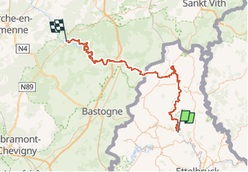
🇱🇺 🇧🇪 Cette randonnée de 104 km, nous emmène de part et d’autre de la frontière belgo-luxembourgeoise de Kautenbach à La Roche-en-Ardenne.
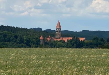
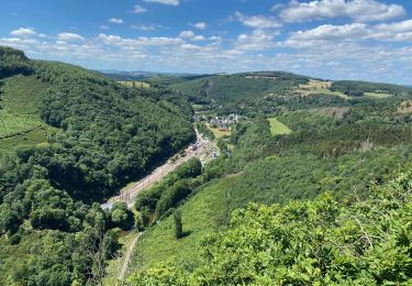
Au nord du Luxembourg, la région Éislek impressionne par la richesse de ses forêts, ses collines vertes, ses vallées profondes et ses plateaux venteux.

➡️ Marchez en cinq étapes journalières à travers de vastes forêts de conifères, le long de pentes raides typiques et découvrez en chemin le patrimoine naturel et culturel des Ardennes.

5 étapes:
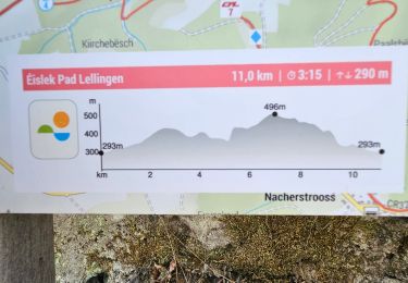
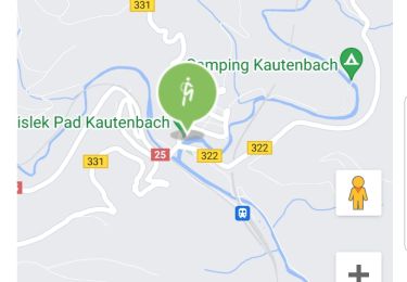
Kautenbach – Clervaux : 25,5 km
Clervaux – Asselborn : 18,8 km
Asselborn – Houffalize (B) : 20,6 km
Houffalize (B) – Nadrin (B) : 23,4 km
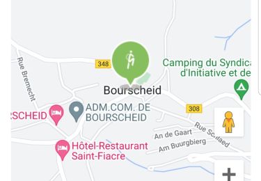
Nadrin (B) – La Roche-en-Ardenne (B) : 18 km
.

Elevation profile

Positioning

Country:
Luxembourg
Region :
Unknown
Department/Province :
Canton Wiltz
Municipality :
Kiischpelt
Location:
Unknown
Start:(UTM)
286390 ; 5537202 (32U) N.

Trails nearby

Trail Walking Goesdorf - Autopedestres : Dahl - Photo
Walking
GUIDE+

Walking

Very easy
(1)
Goesdorf, Unknown, Canton Wiltz, Luxembourg
8.7 km | 12.6 km-effort
Unknown
Yes
Trail Walking Bourscheid - Autopedestres : Bourscheid - Photo
Walking
GUIDE+

Walking

Very easy
(2)
Bourscheid, Unknown, Canton Diekirch, Luxembourg
10.5 km | 15.3 km-effort
Unknown
Yes
Trail Walking Kiischpelt - eislek trail de Kautenbach à Troisvierges  - Photo
Walking
dragonchef

Walking

Difficult
Kiischpelt, Unknown, Canton Wiltz, Luxembourg
42 km | 61 km-effort
12h 30min
No
Trail Walking Kiischpelt - 2023-06-19_15h16m15_eislek-pad-lellingen-1 - Photo
Walking
GUIDE
mumu.larandonneuse

Walking

Medium
Kiischpelt, Unknown, Canton Wiltz, Luxembourg
11.1 km | 15.9 km-effort
3h 37min
Yes
Trail Walking Kiischpelt - 2022-09-22_13h29m24_t62885235_eislek pad kautenbach (1) - Photo
Walking
GUIDE
mumu.larandonneuse

Walking

Medium
Kiischpelt, Unknown, Canton Wiltz, Luxembourg
14.4 km | 22 km-effort
4h 58min
Yes
Trail Walking Bourscheid - 2022-09-22_13h10m58_t62880921_eislek pad bourscheid - Photo
Walking
GUIDE
mumu.larandonneuse

Walking

Medium
Bourscheid, Unknown, Canton Diekirch, Luxembourg
14.8 km | 23 km-effort
5h 10min
Yes
Trail Walking Kiischpelt - Escapardenne Eisleck Trail: Kautenbach - Clervaux - Photo
Walking
dauzata

Walking

Difficult
Kiischpelt, Unknown, Canton Wiltz, Luxembourg
25 km | 38 km-effort
6h 21min
No
Trail Walking Parc Hosingen - Escapardenne Lee Trail: Hoscheid - Kautenbach - Photo
Walking
dauzata

Walking

Medium
Parc Hosingen, Unknown, Canton Clervaux, Luxembourg
15.5 km | 23 km-effort
4h 25min
No
Trail Walking Bourscheid - Escapardenne Lee Trail: Moulin de Bourscheid - Hoscheid - Photo
Walking
dauzata

Walking

Difficult
Bourscheid, Unknown, Canton Diekirch, Luxembourg
19.2 km | 30 km-effort
5h 21min
No


Close
My subscriptions