


20240507 Vascoeuil

Childebert
User
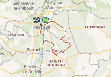

Length
11 km

Max alt
182 m

Uphill gradient
283 m
Km-Effort
14.7 km

Min alt
52 m

Downhill gradient
282 m
Boucle
Yes
Creation date :
2024-05-07 12:01:02.044
Updated on :
2024-05-07 15:11:56.739
3h10
Difficulty : Difficult

FREE GPS app for hiking
 SityTrail
IGN / Geographical institutes
SityTrail Plus
The world is yours!
About
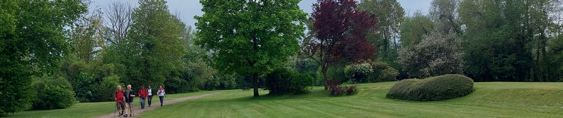
Trail Walking of 11 km to be discovered at Normandy, Eure, Vascœuil. This trail is proposed by Childebert.
Photos

Positioning
Country:
France
Region :
Normandy
Department/Province :
Eure
Municipality :
Vascœuil
Location:
Unknown
Start:(Dec)
Start:(UTM)
382705 ; 5478095 (31U) N.
Comments