


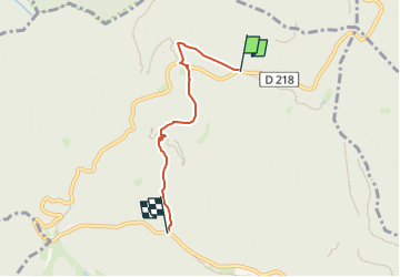
Cascade du Nideck long tour

Joseph Mertens
User

Length
3.8 km

Max alt
684 m

Uphill gradient
44 m
Km-Effort
5.3 km

Min alt
347 m

Downhill gradient
327 m
Boucle
No
Creation date :
2024-05-08 07:11:04.281
Updated on :
2024-05-08 07:11:24.126
1h12
Difficulty : Easy

FREE GPS app for hiking
 SityTrail
IGN / Geographical institutes
SityTrail Plus
The world is yours!
About
Trail Walking of 3.8 km to be discovered at Grand Est, Bas-Rhin, Oberhaslach. This trail is proposed by Joseph Mertens.
Positioning
Country:
France
Region :
Grand Est
Department/Province :
Bas-Rhin
Municipality :
Oberhaslach
Location:
Unknown
Start:(Dec)
Start:(UTM)
374409 ; 5382828 (32U) N.
Comments