


PLATEAU DE SIOUX BLANC - LES AIGUILLES DE VALBELLE - 10KM

jpb83
User
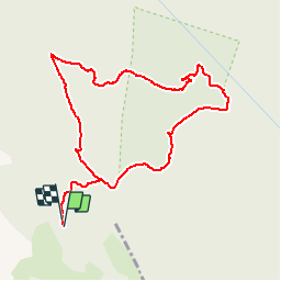

Length
9.9 km

Max alt
644 m

Uphill gradient
263 m
Km-Effort
13.4 km

Min alt
442 m

Downhill gradient
266 m
Boucle
Yes
Creation date :
2016-08-07 00:00:00.0
Updated on :
2016-08-07 00:00:00.0
1h45
Difficulty : Medium

FREE GPS app for hiking
 SityTrail
IGN / Geographical institutes
SityTrail Plus
The world is yours!
About
Trail Running of 9.9 km to be discovered at Provence-Alpes-Côte d'Azur, Var, Signes. This trail is proposed by jpb83.
Description
Le départ se situe à la bergerie de Sioux blanc.


Positioning
Country:
France
Region :
Provence-Alpes-Côte d'Azur
Department/Province :
Var
Municipality :
Signes
Location:
Unknown
Start:(Dec)
Start:(UTM)
737217 ; 4790538 (31T) N.
Comments
tres beau parcours - Magnifique parcours