


Meta bief lac Morond

HB01
User
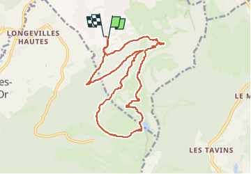

Length
10.3 km

Max alt
1417 m

Uphill gradient
447 m
Km-Effort
16.2 km

Min alt
1039 m

Downhill gradient
455 m
Boucle
Yes
Creation date :
2024-05-09 08:12:23.42
Updated on :
2024-05-09 12:02:00.784
3h05
Difficulty : Medium

FREE GPS app for hiking
 SityTrail
IGN / Geographical institutes
SityTrail Plus
The world is yours!
About
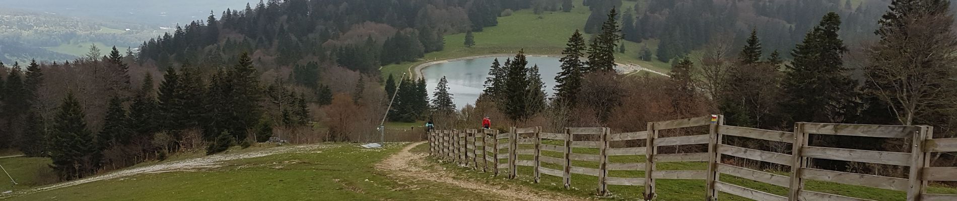
Trail Walking of 10.3 km to be discovered at Bourgogne-Franche-Comté, Doubs, Métabief. This trail is proposed by HB01.
Photos

Positioning
Country:
France
Region :
Bourgogne-Franche-Comté
Department/Province :
Doubs
Municipality :
Métabief
Location:
Unknown
Start:(Dec)
Start:(UTM)
297442 ; 5182200 (32T) N.
Comments