


Gorges d'Oppedette(06-04-2015)

Dervalmarc
User
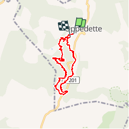


3h26
Difficulty : Medium

FREE GPS app for hiking
 SityTrail
IGN / Geographical institutes
SityTrail Plus
The world is yours!
About
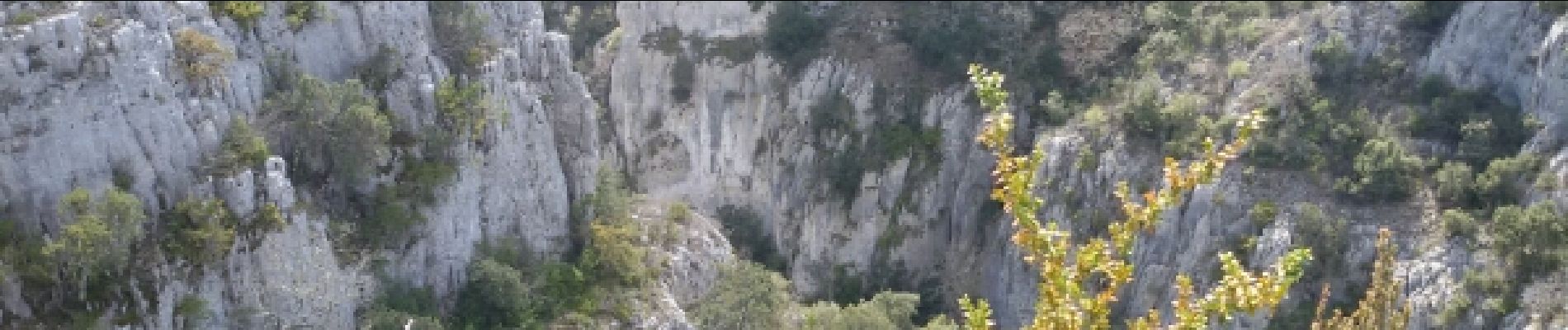
Trail Walking of 9.4 km to be discovered at Provence-Alpes-Côte d'Azur, Alpes-de-Haute-Provence, Oppedette. This trail is proposed by Dervalmarc.
Description
Très belle rando à n'entreprendre que par beau temps surtout le passage de l 'échelle toujours humide à la montée comme à la descente. Nombreuses main courante .Ne pas souffrir du vertige dans certains passages.
Photos
 - Photo 1")
 - Photo 2")
 - Photo 3")
 - Photo 4")
 - Photo 5")
 - Photo 6")
 - Photo 7")
 - Photo 8")
 - Photo 9")
 - Photo 10")


Positioning
Comments
Excellente application. Ttes satisfaisant.