


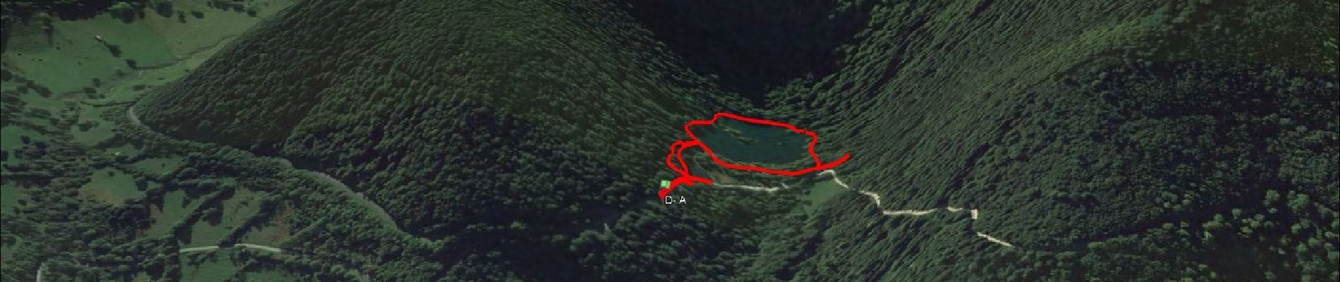
Etang de Bethmale

affinetataille
User GUIDE
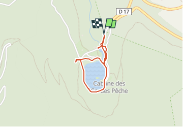

Length
1.3 km

Max alt
1091 m

Uphill gradient
49 m
Km-Effort
2 km

Min alt
1053 m

Downhill gradient
44 m
Boucle
Yes
Creation date :
2024-05-09 13:11:28.874
Updated on :
2024-06-18 18:54:59.361
1h00
Difficulty : Easy

FREE GPS app for hiking
 SityTrail
IGN / Geographical institutes
SityTrail Plus
The world is yours!
About
Trail Walking of 1.3 km to be discovered at Occitania, Ariège, Bethmale. This trail is proposed by affinetataille.
Photos


Positioning
Country:
France
Region :
Occitania
Department/Province :
Ariège
Municipality :
Bethmale
Location:
Unknown
Start:(Dec)
Start:(UTM)
343551 ; 4747400 (31T) N.
Comments