


linceuil

Vero7684
User
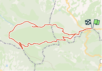

Length
11.8 km

Max alt
1165 m

Uphill gradient
582 m
Km-Effort
19.6 km

Min alt
655 m

Downhill gradient
581 m
Boucle
Yes
Creation date :
2024-05-09 07:34:51.495
Updated on :
2024-05-09 13:12:36.112
4h30
Difficulty : Medium

FREE GPS app for hiking
 SityTrail
IGN / Geographical institutes
SityTrail Plus
The world is yours!
About
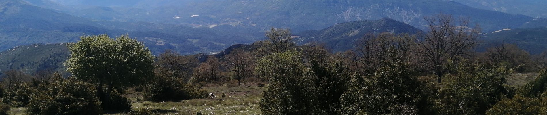
Trail Walking of 11.8 km to be discovered at Auvergne-Rhône-Alpes, Drôme, Sainte-Jalle. This trail is proposed by Vero7684.
Photos


Positioning
Country:
France
Region :
Auvergne-Rhône-Alpes
Department/Province :
Drôme
Municipality :
Sainte-Jalle
Location:
Unknown
Start:(Dec)
Start:(UTM)
681689 ; 4909140 (31T) N.
Comments