


Roc de Cher

dan69390
User
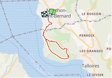

Length
6.8 km

Max alt
628 m

Uphill gradient
193 m
Km-Effort
9.4 km

Min alt
460 m

Downhill gradient
193 m
Boucle
Yes
Creation date :
2024-05-09 11:49:54.0
Updated on :
2024-05-09 14:10:17.275
2h19
Difficulty : Medium

FREE GPS app for hiking
 SityTrail
IGN / Geographical institutes
SityTrail Plus
The world is yours!
About
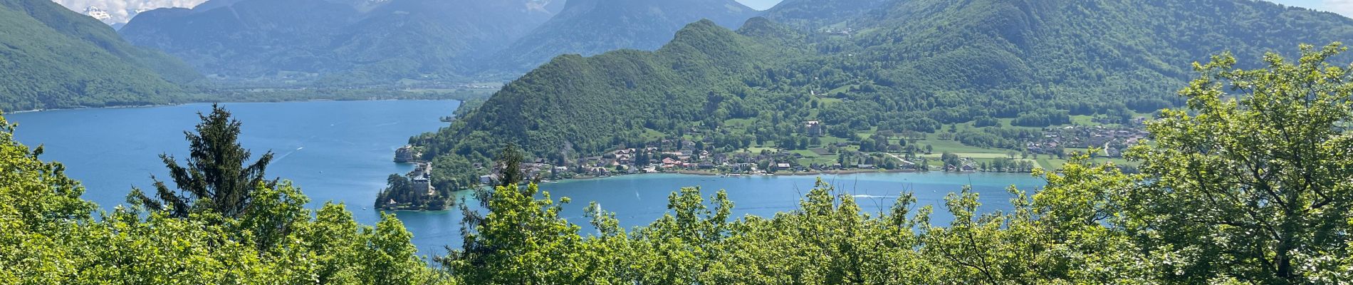
Trail Walking of 6.8 km to be discovered at Auvergne-Rhône-Alpes, Upper Savoy, Menthon-Saint-Bernard. This trail is proposed by dan69390.
Photos

Positioning
Country:
France
Region :
Auvergne-Rhône-Alpes
Department/Province :
Upper Savoy
Municipality :
Menthon-Saint-Bernard
Location:
Unknown
Start:(Dec)
Start:(UTM)
281981 ; 5082051 (32T) N.
Comments