Trail Walking Manhay - RF-Lu-04 En surplomb de l'ancienne ligne SNCV de l'Aisne : Dochamps - Photo

RF-Lu-04 En surplomb de l'ancienne ligne SNCV de l'Aisne : Dochamps

Randonnez sur et autour des GR ® wallons (Sentiers de Grande Randonnée). PRO

© OpenStreetMap contributors
Length
Length
14.4 km
Max alt
Max alt
576 m
Uphill gradient
Uphill gradient
361 m
Km-Effort
Km-Effort  
19.2 km
Min alt
Min alt
404 m
Downhill gradient
Downhill gradient
362 m
Boucle
Boucle
Yes
Creation date :
2019-08-07 07:22:16.994
Updated on :
2022-01-15 13:22:30.905

(4 Reviews)

Walking
Walking
4h05
Difficulty : Unknown

Scan this QR Code to open this trail in the SityTrail application

FREE GPS app for hiking

Logo SityTrail SityTrail

IGN / Geographical institutes

Download SityTrail from the App Store Download SityTrail from Google Play

Logo SityTrail SityTrail World

The world is yours!

Download SityTrail from the App Store Download SityTrail from Google Play Download SityTrail on Huawei AppGallery

About

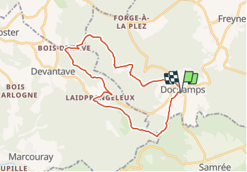
Trail Walking of 14.4 km to be discovered at Wallonia, Luxembourg, Manhay. This trail is proposed by GR Rando.

Description

En surplomb de l'ancienne ligne SNCV de l'Aisne : Dochamps
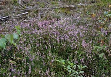
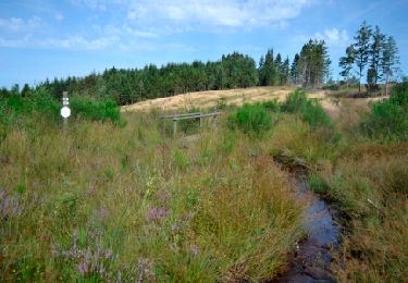
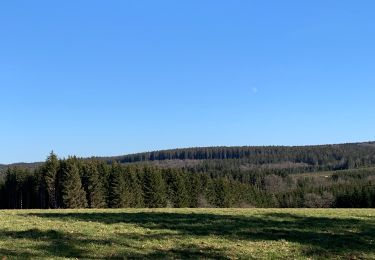
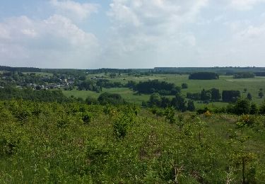
Dans quel type de paysage randonnons-nous ?
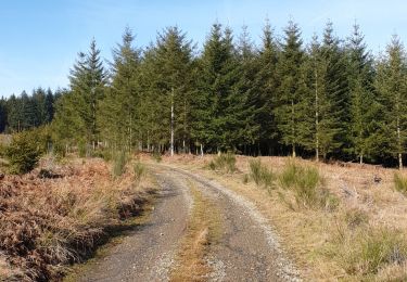
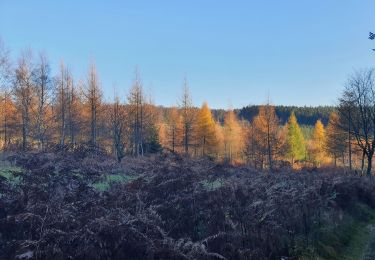
La balade évolue entre 400 et 500 mètres d’altitude dans un massif forestier à l’ouest de Dochamps.
Où démarrons-nous ?
À Dochamps (carte Michelin n° 534, pli S/21), sur la petite place en face de la boulangerie (épicerie fine/dépôt de pains) et du café-taverne-restaurant.
Comment y arriver ?
Rallier Dochamps, soit à partir de Manhay (carte Michelin n°534, pli T/21) (sur la N30, Aywaille - Bastogne) (9 kilomètres), soit au départ de Samrée (carte Michelin n° 534, pli S/21) (sur N89, Baraque de Fraiture - La Roche-en-Ardenne) (3 kilomètres).
Combien de kilomètres ?
14,5 km. Possibilité de ramener cette balade à 10,5 km.
Quelle difficulté ?
Cette rando est un peu plus longue que les autres. Montées et descentes se succèdent, mais, mis à part la forte côte au sortir de Dochamps, elles ne comportent aucune difficulté.
Sur quel GR randonnons-nous ?
Cette balade emprunte un tronçon du GR 14 (Sentier de l’Ardenne : Malmedy - Bouillon - Sedan).
Quelle est la carte IGN de référence ?
Carte IGN au 1:20 000, 55/5-6 « Hotton - Rendeux ».
Que découvrons-nous aujourd’hui ?
En cours de balade (ou après), nous découvrirons le monde de la forêt de façon originale au « Parc Chlorophylle ».
Transports en commun ?
Aucune possibilité (le bus TEC n° 11 y est rare en semaine et absent le week-end).

Points of interest

Point of interest Manhay - Parc Chlorophylle - Photo
GR Rando

Positioning

Country:
Belgium
Region :
Wallonia
Department/Province :
Luxembourg
Municipality :
Manhay
Location:
Unknown
Start:(UTM)
687026 ; 5567822 (31U) N.

Comments

Please log in to post a review or rate the element


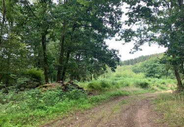
Superbe parcours entièrement boisé


Magnifique parcours. Je l’ai fait avec léger brouillard, un peu de neige. Superbe. Difficulté moyenne


Trails nearby

Trail Walking Manhay - Erezée - Circuit Natura 2000
Walking
GUIDE+

Walking

Medium
(7)
Manhay, Wallonia, Luxembourg, Belgium
8.3 km | 11.9 km-effort
2h 30min
No
Trail Walking Manhay - Odeigne, Natura 2000 - Des sites qui valent le détour. Lx10 - Photo
Walking
GUIDE+

Walking

Easy
(4)
Manhay, Wallonia, Luxembourg, Belgium
8.8 km | 10.9 km-effort
2h 23min
Yes
Trail Walking La Roche-en-Ardenne - Samree-maboge-Samree - Photo
Walking
negi

Walking

(1)
La Roche-en-Ardenne, Wallonia, Luxembourg, Belgium
15.2 km | 21 km-effort
3h 36min
Yes
Trail Walking La Roche-en-Ardenne - Balade à Samrée - Photo
Walking
GUIDE
Desrumaux

Walking

Very easy
(1)
La Roche-en-Ardenne, Wallonia, Luxembourg, Belgium
11.2 km | 15.7 km-effort
4h 30min
Yes
Trail Walking La Roche-en-Ardenne - Un petit tour dans les fagnes de la goutte en partant de Samree  - Photo
Walking
negi

Walking

(2)
La Roche-en-Ardenne, Wallonia, Luxembourg, Belgium
14.6 km | 18.5 km-effort
3h 0min
Yes
Trail Walking La Roche-en-Ardenne - rando samrée 26/11/2020 - Photo
Walking
japy54

Walking

Medium
(2)
La Roche-en-Ardenne, Wallonia, Luxembourg, Belgium
19 km | 25 km-effort
4h 44min
Yes
Trail Walking Érezée - rando amonines 26/10/2020 - Photo
Walking
japy54

Walking

Medium
(1)
Érezée, Wallonia, Luxembourg, Belgium
13.3 km | 18 km-effort
3h 2min
Yes
Trail Walking La Roche-en-Ardenne - très belle  - Photo
Walking
Chanchan63

Walking

Very easy
(1)
La Roche-en-Ardenne, Wallonia, Luxembourg, Belgium
22 km | 31 km-effort
4h 49min
Yes
Trail Walking Manhay - oster - Photo
Walking
dhouet

Walking

Medium
(3)
Manhay, Wallonia, Luxembourg, Belgium
6 km | 8.2 km-effort
1h 19min
Yes


Close
My subscriptions