


viarmes

olivieraron
User
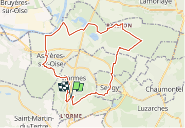

Length
17.9 km

Max alt
144 m

Uphill gradient
283 m
Km-Effort
22 km

Min alt
22 m

Downhill gradient
284 m
Boucle
Yes
Creation date :
2024-05-10 10:44:23.917
Updated on :
2024-05-10 10:51:10.084
4h55
Difficulty : Very difficult

FREE GPS app for hiking
 SityTrail
IGN / Geographical institutes
SityTrail Plus
The world is yours!
About
Trail Walking of 17.9 km to be discovered at Ile-de-France, Val-d'Oise, Viarmes. This trail is proposed by olivieraron.
Positioning
Country:
France
Region :
Ile-de-France
Department/Province :
Val-d'Oise
Municipality :
Viarmes
Location:
Unknown
Start:(Dec)
Start:(UTM)
453886 ; 5440675 (31U) N.
Comments