


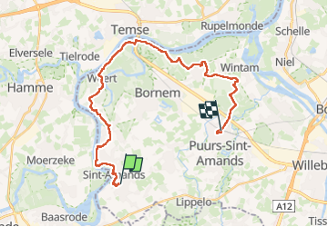
Sint-Amands - Mariekerke - Weerde - Hingene - Puurs

kimpej
User

Length
26 km

Max alt
19 m

Uphill gradient
105 m
Km-Effort
27 km

Min alt
-2 m

Downhill gradient
104 m
Boucle
No
Creation date :
2024-05-10 07:20:14.895
Updated on :
2024-05-11 14:41:21.979
5h37
Difficulty : Difficult

FREE GPS app for hiking
 SityTrail
IGN / Geographical institutes
SityTrail Plus
The world is yours!
About
Trail Walking of 26 km to be discovered at Flanders, Antwerp, Puurs-Sint-Amands. This trail is proposed by kimpej.
Positioning
Country:
Belgium
Region :
Flanders
Department/Province :
Antwerp
Municipality :
Puurs-Sint-Amands
Location:
Unknown
Start:(Dec)
Start:(UTM)
584570 ; 5656290 (31U) N.
Comments