Trail Walking Vecoux - Chaudefontaine -grand lac- Chaudefontaine  - Photo

Chaudefontaine -grand lac- Chaudefontaine

© OpenStreetMap contributors
Length
Length
8.6 km
Max alt
Max alt
703 m
Uphill gradient
Uphill gradient
358 m
Km-Effort
Km-Effort  
13.4 km
Min alt
Min alt
487 m
Downhill gradient
Downhill gradient
359 m
Boucle
Boucle
Yes
Creation date :
2024-05-10 09:18:27.0
Updated on :
2024-05-11 12:18:54.268

(0 Reviews)

Walking
Walking
3h02
Difficulty : Difficult

Scan this QR Code to open this trail in the SityTrail application

FREE GPS app for hiking

Logo SityTrail SityTrail

IGN / Geographical institutes

Download SityTrail from the App Store Download SityTrail from Google Play

Logo SityTrail SityTrail Plus

The world is yours!

Download SityTrail from the App Store Download SityTrail from Google Play Download SityTrail on Huawei AppGallery

About

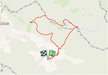
Trail Walking of 8.6 km to be discovered at Grand Est, Vosges, Vecoux. This trail is proposed by nicolasdresse.

Description

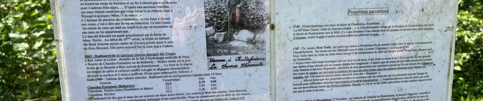
Une randonnée très sympathique et bien balisée . Au passage la fontaine de chaudefontaine entourée d'un puits. Elle est à 21° toute l'année. Passage par 2 lacs et retour.
Randonnée ombragée et assez pentue par moments. Prévoir de bonnes chaussures et déconseillée aux enfants de moins de 10 ans.

Elevation profile

Photos

Points of interest

Point of interest Vecoux - PUITS DE LA FONTAINE  - Photo
nicolasdresse

Positioning

Country:
France
Region :
Grand Est
Department/Province :
Vosges
Municipality :
Vecoux
Location:
Unknown
Start:(UTM)
325678 ; 5315200 (32T) N.


Close
My subscriptions