


Double Mont Saint-Odile

apa
User
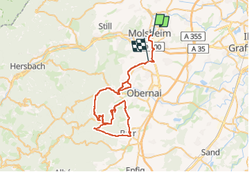

Length
70 km

Max alt
764 m

Uphill gradient
1397 m
Km-Effort
89 km

Min alt
174 m

Downhill gradient
1387 m
Boucle
No
Creation date :
2024-05-10 12:18:11.0
Updated on :
2024-05-10 16:52:36.163

FREE GPS app for hiking
 SityTrail
IGN / Geographical institutes
SityTrail Plus
The world is yours!
About
Trail of 70 km to be discovered at Grand Est, Bas-Rhin, Molsheim. This trail is proposed by apa.
Positioning
Country:
France
Region :
Grand Est
Department/Province :
Bas-Rhin
Municipality :
Molsheim
Location:
Unknown
Start:(Dec)
Start:(UTM)
389181 ; 5377175 (32U) N.
Comments