Trail Walking Navour-sur-Grosne - Brandon 8,5 km - Photo
 rvapeldo
rvapeldo

User GUIDE

© OpenStreetMap contributors
Length
Length
8.5 km
Max alt
Max alt
443 m
Uphill gradient
Uphill gradient
296 m
Km-Effort
Km-Effort  
12.4 km
Min alt
Min alt
311 m
Downhill gradient
Downhill gradient
300 m
Boucle
Boucle
Yes
Creation date :
2024-05-12 06:52:01.0
Updated on :
2024-05-12 20:49:47.424

(0 Reviews)

Walking
Walking
2h55
Difficulty : Medium

Scan this QR Code to open this trail in the SityTrail application

FREE GPS app for hiking

Logo SityTrail SityTrail

IGN / Geographical institutes

Download SityTrail from the App Store Download SityTrail from Google Play

Logo SityTrail SityTrail World

The world is yours!

Download SityTrail from the App Store Download SityTrail from Google Play Download SityTrail on Huawei AppGallery

About

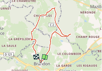
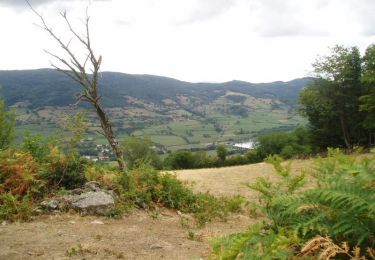
Trail Walking of 8.5 km to be discovered at Bourgogne-Franche-Comté, Saône-et-Loire, Navour-sur-Grosne. This trail is proposed by rvapeldo.

Description

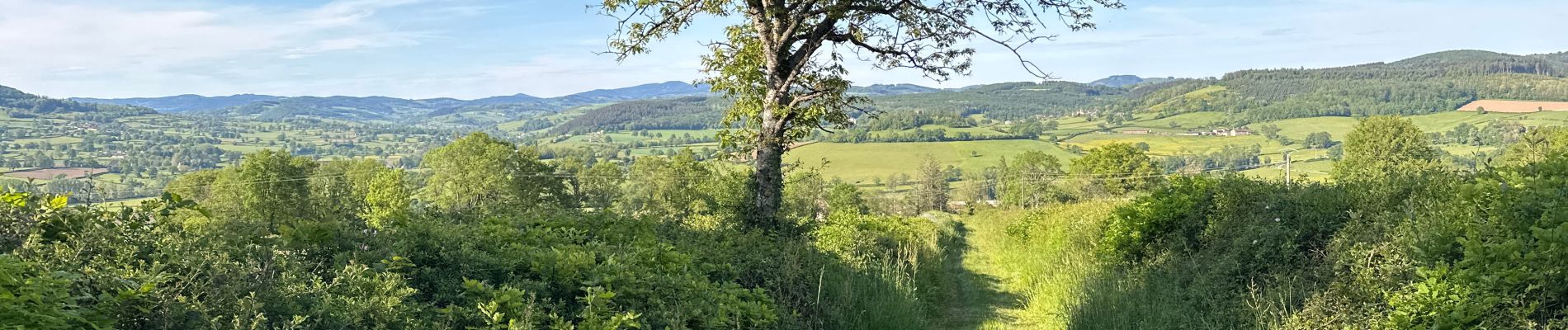
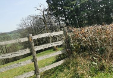
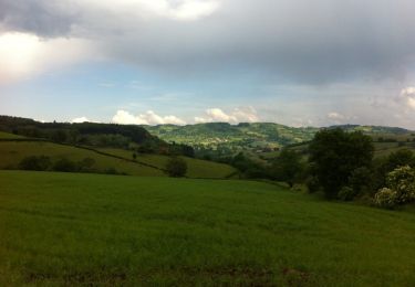
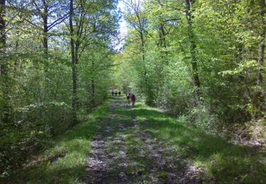
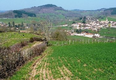
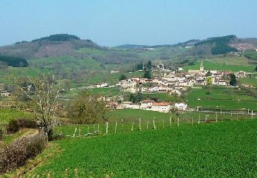
Promenade au départ de Brandon, dans Haut Clusinois, près de Cluny, à travers un beau paysage de collines et de bois. Elle a duré une matinée, mais il y a moyen de l’étendre pour une journée complète.

Elevation profile

Photos

Positioning

Country:
France
Region :
Bourgogne-Franche-Comté
Department/Province :
Saône-et-Loire
Municipality :
Navour-sur-Grosne
Location:
Unknown
Start:(UTM)
620559 ; 5136186 (31T) N.

Trails nearby

Trail Walking Bergesserin - bergesserin  - Photo
Walking
darrisa

Walking

Medium
Bergesserin, Bourgogne-Franche-Comté, Saône-et-Loire, France
5.6 km | 7.7 km-effort
2h 11min
Yes
Trail Walking Sainte-Cécile - Le haut clunisois  - Photo
Walking
darrisa

Walking

Medium
Sainte-Cécile, Bourgogne-Franche-Comté, Saône-et-Loire, France
14.9 km | 19.6 km-effort
4h 0min
Yes
Trail Walking Sainte-Cécile - bourgvilain - Photo
Walking
darrisa

Walking

Difficult
Sainte-Cécile, Bourgogne-Franche-Comté, Saône-et-Loire, France
6.4 km | 9.4 km-effort
2h 15min
No
Trail Walking Trambly - Trambly - Saint Leger sous la Bussière - Photo
Walking
dominiq

Walking

Very easy
Trambly, Bourgogne-Franche-Comté, Saône-et-Loire, France
12.8 km | 18.5 km-effort
3h 54min
Yes
Trail Walking Curtil-sous-Buffières - Rando du 1er Mai - Curtil sous Buffières - Photo
Walking
tracegps

Walking

Difficult
Curtil-sous-Buffières, Bourgogne-Franche-Comté, Saône-et-Loire, France
25 km | 33 km-effort
5h 30min
Yes
Trail Mountain bike Trambly - Les Serpentines (2012-VTT-25km) - Trambly - Photo
Mountain bike
tracegps

Mountain bike

Difficult
Trambly, Bourgogne-Franche-Comté, Saône-et-Loire, France
25 km | 36 km-effort
2h 30min
Yes
Trail Mountain bike Trambly - Les Serpentines (2012-VTT-35km) - Trambly - Photo
Mountain bike
tracegps

Mountain bike

Very difficult
Trambly, Bourgogne-Franche-Comté, Saône-et-Loire, France
36 km | 52 km-effort
3h 0min
Yes
Trail Walking Navour-sur-Grosne - Les Echeliers - Brandon - Photo
Walking
tracegps

Walking

Medium
Navour-sur-Grosne, Bourgogne-Franche-Comté, Saône-et-Loire, France
9.6 km | 14.2 km-effort
2h 45min
Yes
Trail Walking Mazille - Neronde - Photo
Walking
darrisa

Walking

Very difficult
Mazille, Bourgogne-Franche-Comté, Saône-et-Loire, France
21 km | 27 km-effort
4h 33min
No


Close
My subscriptions