


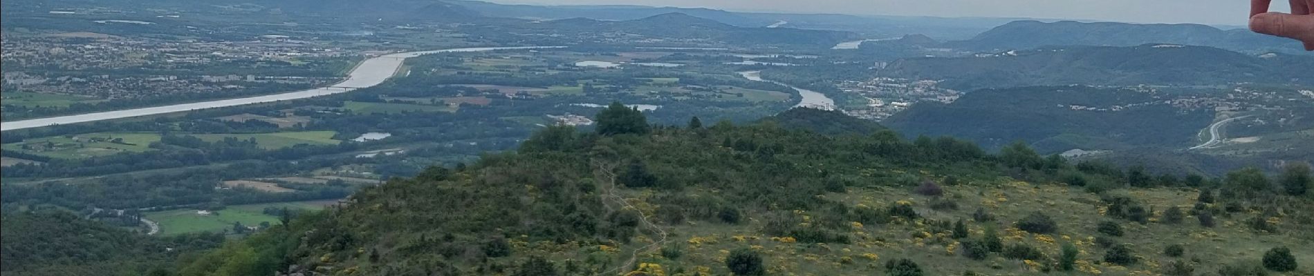
rochemeaure pic de chenavarie

Joel26400
User
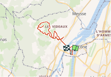

Length
15.4 km

Max alt
491 m

Uphill gradient
506 m
Km-Effort
22 km

Min alt
68 m

Downhill gradient
509 m
Boucle
Yes
Creation date :
2024-05-12 06:48:54.793
Updated on :
2024-05-12 14:01:29.774
4h51
Difficulty : Very difficult

FREE GPS app for hiking
 SityTrail
IGN / Geographical institutes
SityTrail Plus
The world is yours!
About
Trail Walking of 15.4 km to be discovered at Auvergne-Rhône-Alpes, Drôme, Ancône. This trail is proposed by Joel26400.
Description
château et village de caractère
Photos


Positioning
Country:
France
Region :
Auvergne-Rhône-Alpes
Department/Province :
Drôme
Municipality :
Ancône
Location:
Unknown
Start:(Dec)
Start:(UTM)
636167 ; 4937312 (31T) N.
Comments