


Plan-Mayens - Vermala

Maison du Tourisme Crans-Montana
Randonnées de la Maison du tourisme de Crans-Montana GUIDE+
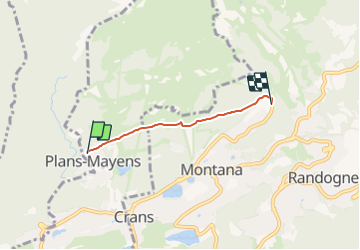

Length
2.8 km

Max alt
1727 m

Uphill gradient
101 m
Km-Effort
4 km

Min alt
1627 m

Downhill gradient
66 m
Boucle
No
Creation date :
2014-12-10 00:00:00.0
Updated on :
2014-12-10 00:00:00.0
53m
Difficulty : Unknown

FREE GPS app for hiking
 SityTrail
IGN / Geographical institutes
SityTrail Plus
The world is yours!
About
Trail Other activity of 2.8 km to be discovered at Valais/Wallis, Sierre, Lens. This trail is proposed by Maison du Tourisme Crans-Montana.
Positioning
Country:
Switzerland
Region :
Valais/Wallis
Department/Province :
Sierre
Municipality :
Lens
Location:
Unknown
Start:(Dec)
Start:(UTM)
381512 ; 5130145 (32T) N.
Comments