


parpaillon

TOULAUDIN
User
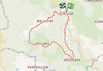

Length
8.8 km

Max alt
1183 m

Uphill gradient
285 m
Km-Effort
12.6 km

Min alt
980 m

Downhill gradient
279 m
Boucle
Yes
Creation date :
2024-05-14 07:36:11.522
Updated on :
2024-05-14 11:01:32.967
3h24
Difficulty : Very easy

FREE GPS app for hiking
 SityTrail
IGN / Geographical institutes
SityTrail Plus
The world is yours!
About
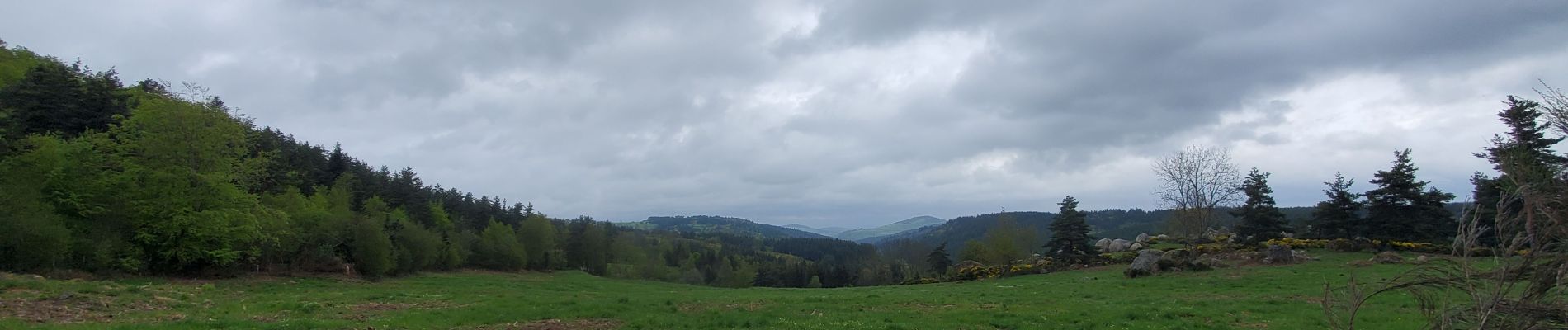
Trail Walking of 8.8 km to be discovered at Occitania, Lozère, Auroux. This trail is proposed by TOULAUDIN.
Photos


Positioning
Country:
France
Region :
Occitania
Department/Province :
Lozère
Municipality :
Auroux
Location:
Unknown
Start:(Dec)
Start:(UTM)
557624 ; 4955757 (31T) N.
Comments