


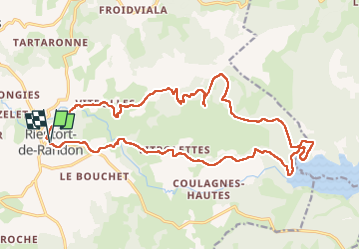

23 km | 32 km-effort

User


FREE GPS app for hiking
 SityTrail
IGN / Geographical institutes
SityTrail World
The world is yours!
Trail Walking of 24 km to be discovered at Occitania, Lozère, Monts-de-Randon. This trail is proposed by Alain28/01.
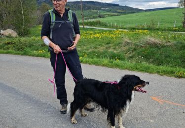
Belle journée à travers, pissenlits, genets en fleurs et forêts d'épicéas.
Notre compagnon du jour Owen nous a suivi sur tout le parcours.

Walking


sport

Mountain bike
Mountain bike

Other activity
On foot

Walking
Walking
Walking