


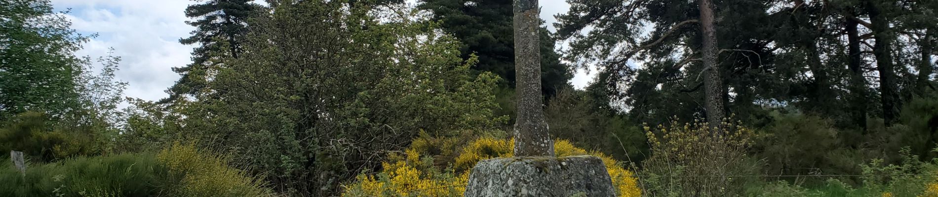
la croix Blanche

TOULAUDIN
User
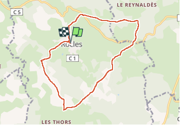

Length
9 km

Max alt
1160 m

Uphill gradient
212 m
Km-Effort
11.8 km

Min alt
1003 m

Downhill gradient
213 m
Boucle
Yes
Creation date :
2024-05-15 07:24:30.519
Updated on :
2024-05-15 14:48:26.611
2h58
Difficulty : Very easy

FREE GPS app for hiking
 SityTrail
IGN / Geographical institutes
SityTrail Plus
The world is yours!
About
Trail Walking of 9 km to be discovered at Occitania, Lozère, Rocles. This trail is proposed by TOULAUDIN.
Photos


Positioning
Country:
France
Region :
Occitania
Department/Province :
Lozère
Municipality :
Rocles
Location:
Unknown
Start:(Dec)
Start:(UTM)
562012 ; 4951428 (31T) N.
Comments