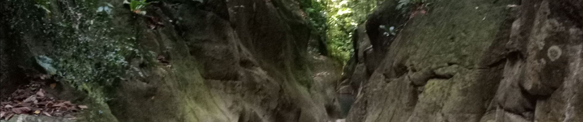
Canyon Rivière Grand Plaine

David25400
User GUIDE
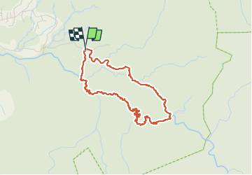

Length
5.8 km

Max alt
305 m

Uphill gradient
254 m
Km-Effort
9.2 km

Min alt
110 m

Downhill gradient
251 m
Boucle
Yes
Creation date :
2024-05-18 18:13:58.658
Updated on :
2024-05-18 20:55:09.296
2h40
Difficulty : Medium

FREE GPS app for hiking
 SityTrail
IGN / Geographical institutes
SityTrail Plus
The world is yours!
About
Trail Walking of 5.8 km to be discovered at Guadeloupe, Unknown, Pointe-Noire. This trail is proposed by David25400.
Description
En remontant et avec moins d'eau : sportif mais ça passe pour Taïga !
Photos


Positioning
Country:
France
Region :
Guadeloupe
Department/Province :
Unknown
Municipality :
Pointe-Noire
Location:
Unknown
Start:(Dec)
Start:(UTM)
632945 ; 1792534 (20Q) N.
Comments