


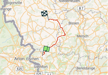
Hobscheid -> Reimberg 19/05/24

fabrice.delfosse
User

Length
24 km

Max alt
399 m

Uphill gradient
526 m
Km-Effort
31 km

Min alt
232 m

Downhill gradient
499 m
Boucle
No
Creation date :
2024-05-19 05:26:16.305
Updated on :
2024-05-19 10:50:06.233
5h23
Difficulty : Difficult

FREE GPS app for hiking
 SityTrail
IGN / Geographical institutes
SityTrail Plus
The world is yours!
About
Trail Walking of 24 km to be discovered at Unknown, Canton Capellen, Habscht. This trail is proposed by fabrice.delfosse.
Positioning
Country:
Luxembourg
Region :
Unknown
Department/Province :
Canton Capellen
Municipality :
Habscht
Location:
Hobscheid
Start:(Dec)
Start:(UTM)
710781 ; 5508571 (31U) N.
Comments