


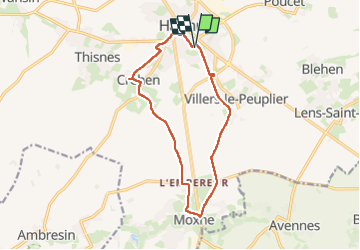
Hannut 12 km

Alain Williaume
User

Length
12 km

Max alt
152 m

Uphill gradient
81 m
Km-Effort
13 km

Min alt
125 m

Downhill gradient
81 m
Boucle
Yes
Creation date :
2024-05-19 08:38:44.0
Updated on :
2024-05-19 10:53:34.263
2h14
Difficulty : Very easy

FREE GPS app for hiking
 SityTrail
IGN / Geographical institutes
SityTrail Plus
The world is yours!
About
Trail Walking of 12 km to be discovered at Wallonia, Liège, Hannut. This trail is proposed by Alain Williaume.
Positioning
Country:
Belgium
Region :
Wallonia
Department/Province :
Liège
Municipality :
Hannut
Location:
Unknown
Start:(Dec)
Start:(UTM)
647118 ; 5614953 (31U) N.
Comments