Rousses - Massevaques - Les Ablatas

cordierlavenant
User
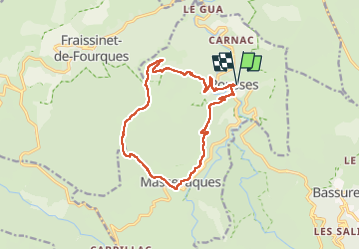

Length
14.4 km

Max alt
1176 m

Uphill gradient
562 m
Km-Effort
22 km

Min alt
710 m

Downhill gradient
561 m
Boucle
Yes
Creation date :
2024-05-19 08:02:37.043
Updated on :
2024-05-19 12:31:28.232
3h58
Difficulty : Medium

FREE GPS app for hiking
 SityTrail
IGN / Geographical institutes
SityTrail Plus
The world is yours!
About
Trail Walking of 14.4 km to be discovered at Occitania, Lozère, Rousses. This trail is proposed by cordierlavenant.
Positioning
Country:
France
Region :
Occitania
Department/Province :
Lozère
Municipality :
Rousses
Location:
Unknown
Start:(Dec)
Start:(UTM)
547072 ; 4894937 (31T) N.
Comments